Resources
Clark Lake Maps
Explore reference maps that support safe recreation, stewardship, and understanding of Clark Lake.
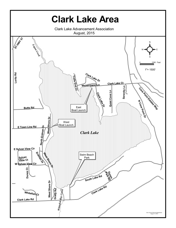
Road Map
A road reference map to help visitors and residents navigate the Clark Lake area.
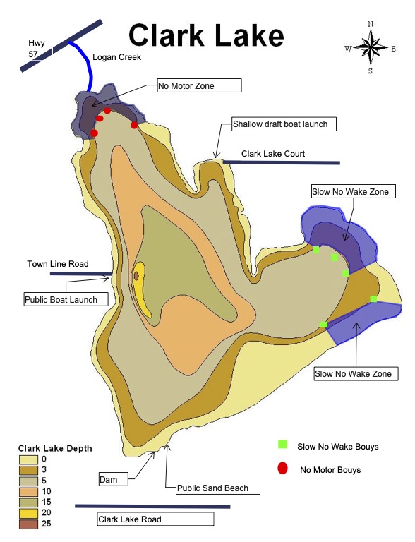
Boat Launch Map/No Motor Ordinance Map/Slow No Wake Ordinance Map
This map outlines the 3 to 8 mile boundary area associated with Clark Lake planning and outreach.
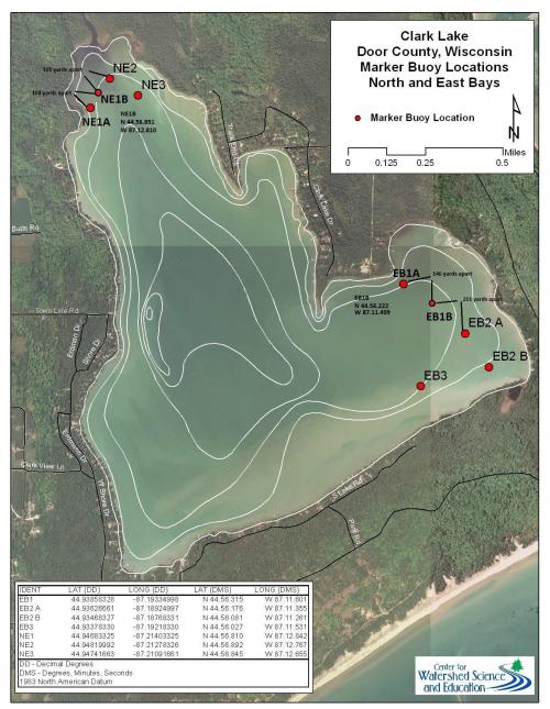
Bouy Marker Map
A map showing the Clark Lake boundary for reference and lake-area awareness.
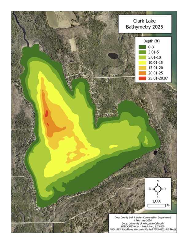
Depth Map
This depth map provides a visual overview of lake depths to support recreation and planning.
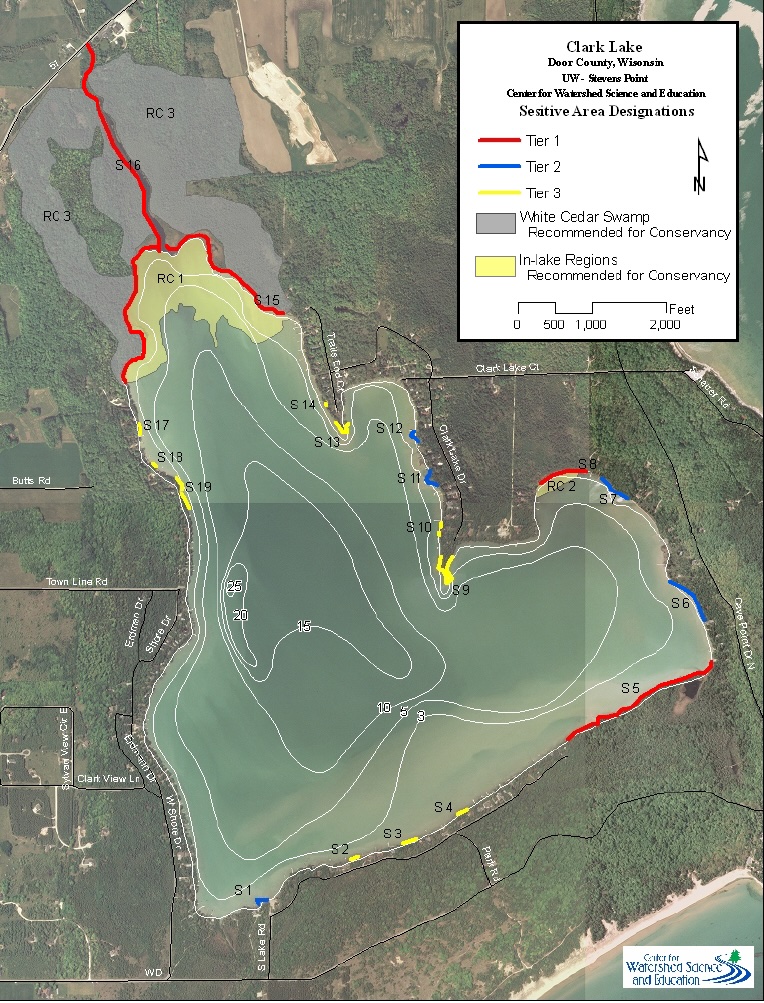
Sensitive Area Map
This map highlights environmentally sensitive areas that help guide responsible lake use and stewardship.
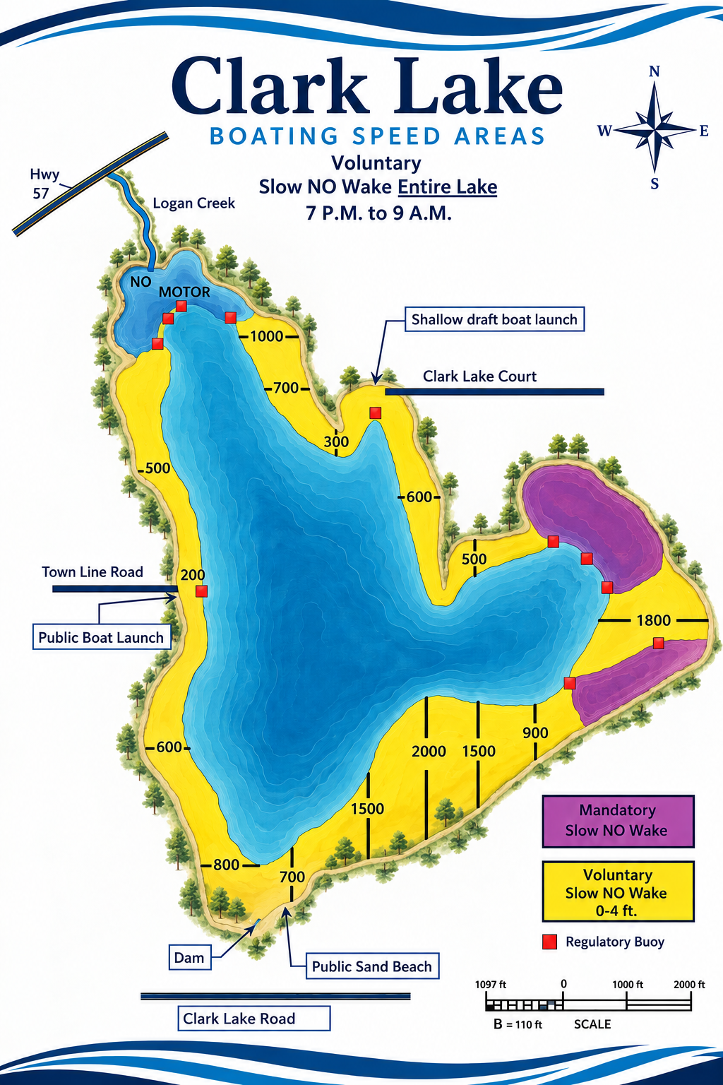
No Wake Area
A map showing the no wake area and distance guidance for safer shared use of the lake.
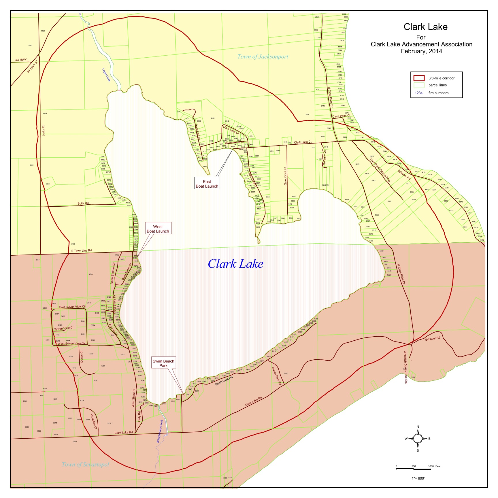
3-8 Mile Boundary Map
A map showing the 3-8 mile boundary area for Clark Lake reference and navigation.